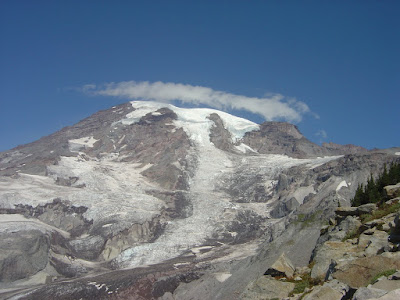
The Skyline Trail Loop is one of the more popular trails, featuring a 1400-foot elevation change. The hike begins at the visitor center (at Paradise point) and is slightly over 5 1/2 miles round trip, or 4 1/2 miles if you take a shortcut.
Going clockwise along the loop, one begins the uphill portion (about 2 miles) of the hike. Right away, Rainier's stunning beauty can be felt as the well-marked trail meanders through lush tree-lined meadows brimming with wildflowers and animal life. Deer, marmots, and birds often venture within viewing distance of the trail.


As the elevation increases, you can get a better look at the glaciers. Soon the trail reaches its highest point at Panorama point - elevation 6800 feet - where hikers often stop to eat their bag lunches and enjoy breathtaking views of the Cascade range. There is also a nearby restroom.


Descending the trail on its east side, hikers overlook a rocky, barren landscape. After about a mile, hikers have the option of returning 1.5 miles to the trail head via the Golden Gate trail, or continuing for 2.5 more miles on the remainder of the Skyline Trail.

Moving further down, the trail transitions back to meadowlands and tree-lined valleys. About half a mile from the trail's end, hikers can stop at Myrtle Falls for a scenic break. Finally the visitor center comes into sight, closing the loop full circle.

Trail: Skyline Trail Loop, 5.5 miles, 1400 ft elevation change
Difficulty: Moderate to Strenuous (elevation change, steep grade, altitude, length)
No comments:
Post a Comment